Scientists Use Satellite Images To Study The Degradation Of Rangelands In Tanzania
-
 Loading...
 - Jonathan Kapinga
- 15 Mar 2023
- 76 Views
- 0 Like
- 0 Comment
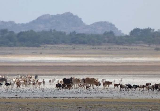
East Africa’s iconic rangelands – under threat from climate change and human activity – have the potential to recover from repeated environmental shocks and degradation, a new study has concluded.
Covering 47% of the Earth’s land surface, rangelands are home to one third of the global population, many of whom are pastoralists who depend on the savannahs to meet their daily need for shelter, water and food.
But because rangelands develop in semi-arid areas and are primarily used for grazing, they are highly vulnerable to changes in rainfall and human pressures.
As part of the study, published in Scientific Reports, scientists combined field data on vegetation with high-resolution satellite images gathered over the last two decades to identify the drivers of degradation within the Northern Tanzanian rangelands.
The study found evidence that sites that are currently degraded are more sensitive to environmental shocks such as drought, but retain their recovery potential. This means that the most degraded sites today were impacted more during shock events, and didn’t have time to fully recover before the next shock occurred.
The ability for the savannah to recover quickly from year to year has long been at the core of traditional management of these rangelands: heavy use over a few years could lead to severe local degradation, but nomadic people moved away for a few years allowing natural recovery.
Today, such movements are increasingly restricted by fragmentation of rangelands, mainly through increasing agriculture, rendering it necessary for pastoralists to remain in what may otherwise have been only temporarily degraded sites, resulting in declining grassland productivity and increased degradation. Read More…